

Department of Natural Resources’ Public School Seismic Safety Report
I collaborated with a senior designer and Reid Middleton’s structural engineering team to create rich data visualizations, materials, and reports that highlighted the seismic risk to Washington Public Schools.
Themes
Illustration, Graphic Design, Infographics
Team
Myself, the senior designer, company structural engineering team, three other subconsultants
Tools
Photoshop, Illustrator, InDesign
Timeline
6 Months
INTRO
Washington State Ranks 2nd for Earthquake Risk, However Most of Its Schools Are Not Prepared
Despite Washington ranking second in the US for earthquake risk, many Washington schools were built before modern building codes with seismic considerations were adopted. Because of this, the Washington Department of Natural Resources (DNR) started a seismic safety assessment project to evaluate the seismic risk of all public schools in Washington state.
My team at Reid Middleton was awarded the contract to create the visualizations, graphics, and materials that would best convey vast amounts of information to them in easy to digest reports.

GOALS
How Might we Lay Out Seismic Data From 222 School Buildings in Easy to Digest Pieces?
After discussing with the engineers what data visualizations they may need, we narrowed their needs down to specific types of data.
Quantitative data would be one of the major high level graphics for this project. This data would encompass data points from all schools into one graphic with the goal of not overwhelming the user, ideally scatter plots and bar charts.
Qualitative data would focus on AutoCAD drawings and calling out specific aspects of the building plans for improvement and updating. Walls and beams will need to be highlighted with special callouts.
RESEARCH SECTION
Artfully Displaying Data Points
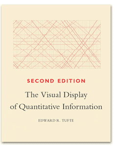
To best display the copious amounts of data points this project would generate, I referred back to Edward Tufte’s writings, a statistician that specializes in visualizing data. His books 1-3 had particularly excellent examples of bad and good data visualization along with valuable insights on achieving a high level of data visualization without overwhelming the user.
Additionally we color coded certain markups on the plan sheets to differentiate between existing features (cool colors) and newer additions (warm colors).
THE REPORT


Differentiating Between Subconsultants
With four companies evaluating 222 public school buildings, there had to be a way to differentiate between each auditing company.
I came up with a color coding system that was initially used in the proposal with Reid Middleton being blue while the other subconsultants were orange, red, and green. This color scheme was also used along with unique relevant graphics to help differentiate each volume.


Providing a High Level Overview on Which Schools Need Immediate Attention
To better highlight which schools needed immediate structural reinforcements (“seismic retrofitting”) I created a scatter chart that highlighted the age of the school, and it’s correlation to it’s risk. I further enhanced this chart for colorblind readers, by using symbols to indicate the type of risk.

I also created a scatter highlighting each school's construction type compared to their seismic risk and year they were built. This helped us learn which type of construction type had the most seismic risk.

We also did a bar chart of all the structures we evaluated showing what construction materials they used.

In-Depth Analysis CAD Drawings For School’s Which Need Attention
To provide a more in depth analysis of the schools at risk, we created graphics that highlight each building's particular risks and recommended seismic upgrades.


Public Outreach
Another big part of this project was public outreach. DNR wanted a way that ordinary Washingtonians and senators in Olympia can quickly look at to get the facts about the project. For this we created a large graphic that summarized many important data points from the report.

RESULTS & NEXT STEPS
Our Report Acted as a Catalyst to Make Washington Public School Building Safer & More Secure!
The report was very well received, garnering intense discussion in the Washington state government and was even reported by the various state news outlets. As a result, additional funding was passed in 2019 for Phase 2 of the school seismic safety project that would see a further 339 public schools and two fire stations assessed.

This was a massive undertaking that I’m particularly proud of. Not only did I create visually stunning graphics but they’re ultimately helping to contribute to the safety of school children across Washington state. It’s especially pleasing to see your work appear on news segments. Ultimately I would have liked to make this an interactive data visualization to add value to the DNR School Seismic Safety webpage located here; https://www.dnr.wa.gov/school-seismic-safety
Feedback on the project? Want to discuss data visualization or Washington School Safety? You can find me on LinkedIn.